第 1/17 張圖片


第 1/17 張圖片
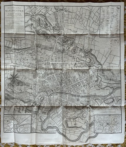
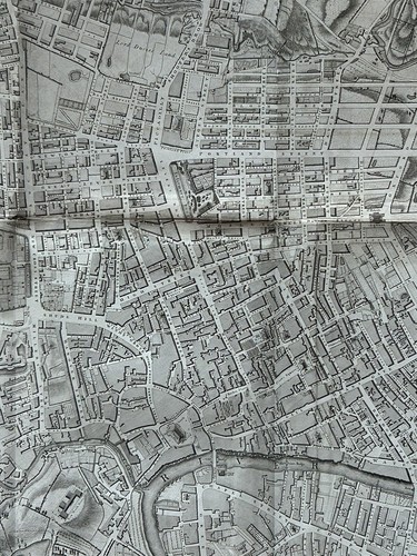
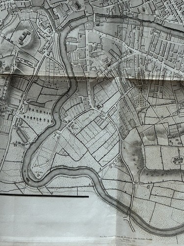
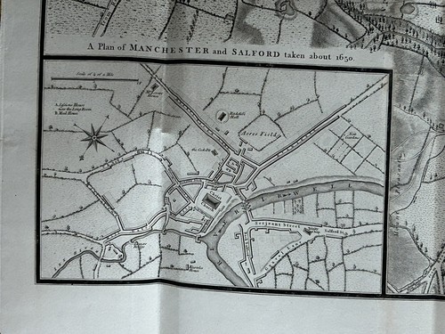
1793 Plan Manchester & Salford Large Folding Map by Charles Laurent 106 cm x 91

GBP 350.00
大約HK$ 3,621.00
或講價
狀況:
“The map is in good condition for its age.”
運費:
GBP 5.00(大約 HK$ 51.73) Royal Mail International Standard.
所在地:Manchester, 英國
送達日期:
估計於 10月2日, 三至 10月8日, 二之間送達 運送地點 43230
退貨:
30 日退貨. 由賣家支付退貨運費.
保障:
請參閱物品說明或聯絡賣家以取得詳細資料。閱覽全部詳情查看保障詳情
(不符合「eBay 買家保障方案」資格)
安心購物
物品細節
- 賣家備註
- “The map is in good condition for its age.”
- Date Range
- 1700-1799
- Antique
- Yes
- Type
- Road Map
- Format
- Folding Map
- Printing Technique
- Copper Plate
- Year
- 1793
- Era
- 1700s
- Cartographer/Publisher
- John Stockdale
- Original/Reproduction
- Antique Original
- City
- Manchester
- Country/Region
- England
- County
- Lancashire, Yorkshire
賣家提供的物品說明

賣家信用評價 (4,842)
- i***i (169)- 買家留下的信用評價。過去 1 個月購買已獲認證Speedy shipping, great packaging, excellent seller! Thank you.
- g***1 (444)- 買家留下的信用評價。過去 1 個月購買已獲認證Great old print, well and safely packaged. Thanks!
- l***e (1364)- 買家留下的信用評價。過去 1 個月購買已獲認證Great item