- 已結束 2024 年 5 月 23 日FRANCE. Vintage Soviet Reference map, scale 1:1 750 000, ed. 1972Opens in a new window or tab高度評價賣家高度評價賣家ursansdd (1,404) 100%
- 已結束 2024 年 5 月 23 日Paris France 1975 Vintage Michelin Road Map Plan De Paris IN FRENCHOpens in a new window or tabpmkehoe (8,796) 99.8%
- 已結束 2024 年 5 月 23 日Vintage St Michael 1700’s Map Of The Uk FramedOpens in a new window or tab提供海關服務及全球追蹤資料dancur5913 (228) 98.6%
- 已賣出 2024 年 5 月 23 日HAMPSHIRE NORTH BY WILLIAM MUDGE c1817 GENUINE 1st EDITION ORDNANCE SURVEY MAPOpens in a new window or tabasjvince (1,646) 100%
- 已結束 2024 年 5 月 23 日1836 antique PARIS folding MAP nouveau plan routico ville de paris chez rosselinOpens in a new window or tabantique.cottage (12,554) 100%
- 已結束 2024 年 5 月 23 日map River Thames Streatley and Goring to Basildon Taunt 1885Opens in a new window or tabraremapsandprints (1,514) 100%
- 已賣出 2024 年 5 月 23 日BEXLEYHEATH, CRAYFORD, DARTFORD, GRAVESEND original antique road map CARY, 1790Opens in a new window or tabmapsetcetera1 (2,171) 100%
- 已結束 2024 年 5 月 23 日Vintage Valence, France Pocket Map 1970Opens in a new window or tab提供海關服務及全球追蹤資料one-of-a-kind-finds (1,991) 99.8%
- 已賣出 2024 年 5 月 23 日MONUMENTAL PLAN OF PARIS by Olivier TRUSCHET 1877 (PLAN DE BALE) ON LINEN 19e COpens in a new window or tab高度評價賣家高度評價賣家efi6 (1,538) 99.3%
- 已結束 2024 年 5 月 23 日2 Antique Vintage Fragile Maps of England Ely Norfolk Suffolk Parchment PaperOpens in a new window or tabgulfwarvet45 (2,012) 100%
- 已結束 2024 年 5 月 23 日Book page of Englsh road maps by Edward Mogg 1814. London to MargateOpens in a new window or tabantiquelord (2,772) 100%
- 已結束 2024 年 5 月 23 日1708 ANN Queen of GREAT BRITAIN FRANCE & IreLand Map Of EUROPEOpens in a new window or tabbplilly2004 (718) 100%
- 已賣出 2024 年 5 月 23 日Vintage Michelin French Map - Carte de SORTIES de PARIS No.100 - Touring MapOpens in a new window or tab高度評價賣家高度評價賣家提供海關服務及全球追蹤資料sycamorebooks (58,332) 100%
- 已賣出 2024 年 5 月 23 日Vintage Michelin French Map - CAEN-PARIS No.55 - RAC Touring MapOpens in a new window or tab高度評價賣家高度評價賣家提供海關服務及全球追蹤資料sycamorebooks (58,332) 100%
- 已賣出 2024 年 5 月 23 日Vintage Michelin French Map - LE MANS-PARIS No.60 - RAC Touring MapOpens in a new window or tab高度評價賣家高度評價賣家提供海關服務及全球追蹤資料sycamorebooks (58,332) 100%
- 已結束 2024 年 5 月 23 日RARE Original Harry Margary Print (1971) London John Rorque No 11 Of 24Opens in a new window or tab提供海關服務及全球追蹤資料muzixman007 (389) 83.3%
- 已結束 2024 年 5 月 23 日1812 MAP KENT ENVIRONS OF MARGATE & RAMSGATE + SANDWICH BY CARY PART HAND-COLOpens in a new window or tab提供海關服務及全球追蹤資料moscow1910 (1,418) 100%
- 已結束 2024 年 5 月 23 日Vintage Map: London For Free Pocket-Sized Olympics Guide, The Times, 2012Opens in a new window or tab提供海關服務及全球追蹤資料theclubhousevintage (1,644) 100%
- 已賣出 2024 年 5 月 23 日1896 Map of LE HAVRE. antique print FRANCEOpens in a new window or tabandant7941 (37) 100%
- 已結束 2024 年 5 月 23 日Original Map of Southern France (1811)in ancient timesOpens in a new window or tabcwhcollectables (15,996) 100%
- 已賣出 2024 年 5 月 23 日1900 Notting Hill Shepherds Bush Antique London Street Plan by George PhilipOpens in a new window or tab高度評價賣家高度評價賣家diddersgoods (2,933) 100%
- 已賣出 2024 年 5 月 23 日Vintage Road Map Of Oxford By Oxford Estates With Advertising 68 St AldatesOpens in a new window or tab提供海關服務及全球追蹤資料crumbs-23 (920) 99.6%
- 已賣出 2024 年 5 月 23 日Antique map of the North Riding of Yorkshire by Thomas Moules 1842Opens in a new window or tab提供海關服務及全球追蹤資料michaelmapman1 (606) 100%
- 已結束 2024 年 5 月 23 日Antique Map: Plan of Exeter Cathedral, Devon, by John Bartholomew, 1920, B/WOpens in a new window or tab提供海關服務及全球追蹤資料theclubhousevintage (1,644) 100%
- 已結束 2024 年 5 月 23 日Antique Map: England & Wales (South), United Kingdom, Universal Atlas, 1893Opens in a new window or tab提供海關服務及全球追蹤資料theclubhousevintage (1,644) 100%
- 已結束 2024 年 5 月 23 日Antique Map: Leeds & Environs by W & A K Johnston, New Popular Educator, 1899Opens in a new window or tab提供海關服務及全球追蹤資料theclubhousevintage (1,644) 100%
- 已結束 2024 年 5 月 23 日Antique Map: Northamptonshire (North) by John Dower, Weekly Dispatch, 1860Opens in a new window or tab提供海關服務及全球追蹤資料theclubhousevintage (1,644) 100%
- 已結束 2024 年 5 月 23 日Antique Map: South-East France & Corsica, The Universal Atlas, 1893Opens in a new window or tab提供海關服務及全球追蹤資料theclubhousevintage (1,644) 100%
- 已結束 2024 年 5 月 22 日Antique Map Isle Of Man 1846 Drawn By R Creighton Engraved By J & C WalkerOpens in a new window or tab提供海關服務及全球追蹤資料chriskh (765) 100%
- 已結束 2024 年 5 月 22 日Antique Map Thomas Moule Isle Of Man 1843 Pub By G Virtue Steel Plate EngravedOpens in a new window or tab提供海關服務及全球追蹤資料chriskh (765) 100%
- 已結束 2024 年 5 月 22 日Antique Map Sidney Hall Isle Of Man Guernsey And Jersey c1842 Steel EngravingOpens in a new window or tab提供海關服務及全球追蹤資料chriskh (765) 100%
- 已結束 2024 年 5 月 22 日c1854 FRANCE Genuine Antique Map by Rapkin Original Outline Hand ColouringOpens in a new window or tab14jak (4,257) 100%
- 已賣出 2024 年 5 月 22 日18thC Ogilby map New & Correct Map the Roads of England Travellers Pocket GuideOpens in a new window or tab提供海關服務及全球追蹤資料bendyboy66 (3,812) 0%
- 已賣出 2024 年 5 月 22 日Original antique county map NORTHUMBERLAND, J.Ellis, c.1765Opens in a new window or tabmapsetcetera1 (2,171) 100%
- 已結束 2024 年 5 月 22 日Old Antique Ordnance Map 1926 Shropshire XIV.1 Balmer Heath Hampton Bank ...Opens in a new window or tab提供海關服務及全球追蹤資料wigwomble (1,085) 100%
- 已結束 2024 年 5 月 22 日Old Antique Ordnance Map 1927 Lancashire XCII.2 Westhead Village & Lathom ...Opens in a new window or tab提供海關服務及全球追蹤資料wigwomble (1,085) 100%
- 已結束 2024 年 5 月 22 日Old Antique Ordnance Map 1927 Lancashire XCIX.6 Netherton & Ford BootleOpens in a new window or tab提供海關服務及全球追蹤資料wigwomble (1,085) 100%
- 已結束 2024 年 5 月 22 日Old Antique Ordnance Map 1937 Lancashire CVIII.9 Sutton Mannor &Clock Face ...Opens in a new window or tab提供海關服務及全球追蹤資料wigwomble (1,085) 100%
- 已結束 2024 年 5 月 22 日Old Antique Ordnance Map 1927 Lancashire XCVIII.8 Crosby & Blundellsands ...Opens in a new window or tab提供海關服務及全球追蹤資料wigwomble (1,085) 100%
- 已結束 2024 年 5 月 22 日Old Antique Ordnance Map 1929 Yorkshire CXIX.14 Littlethorpe & Markenfield HallOpens in a new window or tab提供海關服務及全球追蹤資料wigwomble (1,085) 100%
- 已結束 2024 年 5 月 22 日Old Antique Ordnance Map 1937 Lancashire CVII.9 Liverpool Page Moss & SwansideOpens in a new window or tab提供海關服務及全球追蹤資料wigwomble (1,085) 100%
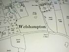
- 已結束 2024 年 5 月 22 日Old Antique Ordnance Map 1926 Shropshire XIII.4 Welshampton & Balmer HeathOpens in a new window or tab提供海關服務及全球追蹤資料wigwomble (1,085) 100%
- 已結束 2024 年 5 月 22 日Old Antique Special Ordnance Map 1908 Cheshire XIII.1.S.W Wirral Saughall MassieOpens in a new window or tab提供海關服務及全球追蹤資料wigwomble (1,085) 100%
- 已結束 2024 年 5 月 22 日Old Antique Ordnance Map 1928 Lancashire CVIII.3 Earlestown Newton-le-Willows ..Opens in a new window or tab提供海關服務及全球追蹤資料wigwomble (1,085) 100%
- 已結束 2024 年 5 月 22 日Old Antique Ordnance Map 1926 Shropshire VIII.10 Ightfield & Ightfield Heath ...Opens in a new window or tab提供海關服務及全球追蹤資料wigwomble (1,085) 100%
- 已結束 2024 年 5 月 22 日Old Antique Ordnance Map 1928 Lancashire LXXXIV.9 Burscough near OrmskirkOpens in a new window or tab提供海關服務及全球追蹤資料wigwomble (1,085) 100%
- 已結束 2024 年 5 月 22 日Old Antique Ordnance Map 1936 Cheshire XXXI.5 Ledsham, Capenhurst & Two MillsOpens in a new window or tab提供海關服務及全球追蹤資料wigwomble (1,085) 100%
- 已結束 2024 年 5 月 22 日Old Antique Ordnance Map 1926 Cheshire VI.16 Wallasey Great Meols & Dove Point .Opens in a new window or tab提供海關服務及全球追蹤資料wigwomble (1,085) 100%
- 已結束 2024 年 5 月 22 日Old Antique Ordnance Map 1932 Lancashire LI.3 Poulton-le-Fylde & Singleton LodgeOpens in a new window or tab提供海關服務及全球追蹤資料wigwomble (1,085) 100%
- 已結束 2024 年 5 月 22 日Old Antique Ordnance Map 1912 Flintshire XXVI.13 Bettisfield Village & Balmer...Opens in a new window or tab提供海關服務及全球追蹤資料wigwomble (1,085) 100%
- 已結束 2024 年 5 月 22 日Old Antique Ordnance Map 1926 Shropshire VII.8 Alkington & Whitchurch ...Opens in a new window or tab提供海關服務及全球追蹤資料wigwomble (1,085) 100%
- 已結束 2024 年 5 月 22 日Old Antique Ordnance Map 1926 Cheshire XII.4 Wirral Saughall Massie Great MeolsOpens in a new window or tab提供海關服務及全球追蹤資料wigwomble (1,085) 100%
- 已結束 2024 年 5 月 22 日Old Antique Ordnance Map 1918 Yorkshire CCXLVI.10 Lindley & Lindley-cum-QuarmbyOpens in a new window or tab提供海關服務及全球追蹤資料wigwomble (1,085) 100%
- 已結束 2024 年 5 月 22 日Old Antique Ordnance Map 1937 Lancashire CVII.11 Whiston & Whiston Cross ...Opens in a new window or tab提供海關服務及全球追蹤資料wigwomble (1,085) 100%
- 已結束 2024 年 5 月 22 日Old Antique Ordnance Map 1926 Shropshire VI.5 Coptiviney & Hampton Wood ...Opens in a new window or tab提供海關服務及全球追蹤資料wigwomble (1,085) 100%
- 已結束 2024 年 5 月 22 日Old Antique Special Ordnance Map 1871 Cheshire VII.10.N.E Wirral Wallasey ...Opens in a new window or tab提供海關服務及全球追蹤資料wigwomble (1,085) 100%
- 已結束 2024 年 5 月 22 日Old Antique Ordnance Map 1926 Shropshire VIII.5 Ash Magna, Edgeley & Brown MossOpens in a new window or tab提供海關服務及全球追蹤資料wigwomble (1,085) 100%
- 已結束 2024 年 5 月 22 日Old Antique Ordnance Map 1926 Shropshire XXI.9 Burlton, Marton & Myddle ...Opens in a new window or tab提供海關服務及全球追蹤資料wigwomble (1,085) 100%
- 已結束 2024 年 5 月 22 日Old Antique Ordnance Map 1926 Shropshire XXI.1 Baschurch & LoppingtonOpens in a new window or tab提供海關服務及全球追蹤資料wigwomble (1,085) 100%
- 已結束 2024 年 5 月 22 日Old Antique Special Ordnance Map 1908 Cheshire VII.14 Birkenhead Bidston Moss ..Opens in a new window or tab提供海關服務及全球追蹤資料wigwomble (1,085) 100%
- 每頁顯示物品數目
 | 按類別選購 |
{"delay":300}